 vesseltracker.com
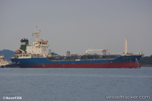
Vessel Galaxy Sambu IMO: 9337860, MMSI: 440824000 Chemical Oil Products Tanker
UTC, 28.66510, 126.69547, course: 244, speed: 11.2
UTC, 28.57937, 126.52500, course: 244, speed: 11.2
2026-02-01 05:41:23 UTC, 28.32497, 126.06178, course: 240, speed: 11.7
Live AIS position:
UTC. 123 nm N of Kumejima),
updated 2026-02-01 05:41:23 UTC.
Find the position of the vessel Galaxy Sambu on the map. The latter are known coordinates and path.
marine traffic ship tracker show on live map
The current position of vessel Galaxy Sambu is 28.32497 lat / 126.06178 lng. Updated: 2026-02-01 05:41:23 UTCDetails:
Last coordinates of the vessel:
UTC, 29.38877, 127.96613, course: 241, speed: 10UTC, 28.66510, 126.69547, course: 244, speed: 11.2
UTC, 28.57937, 126.52500, course: 244, speed: 11.2
2026-02-01 05:41:23 UTC, 28.32497, 126.06178, course: 240, speed: 11.7