 vesseltracker.com
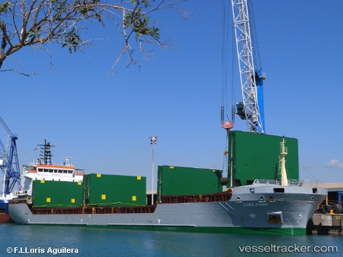
Vessel LUCITA IMO: 9338113, MMSI: 255724000 General Cargo Ship
UTC, 36.77314, -6.46203, course: 180, speed: 0
UTC, 36.77309, -6.46161, course: 203, speed: 0.1
2026-02-25 21:58:49 UTC, 37.13758, -6.09621, course: -1, speed: 10
Live AIS position:
UTC. Near Isla Mayor),
updated 2026-02-25 21:58:49 UTC.
Find the position of the vessel LUCITA on the map. The latter are known coordinates and path.
marine traffic ship tracker show on live map
The current position of vessel LUCITA is 37.13758 lat / -6.09621 lng. Updated: 2026-02-25 21:58:49 UTCCurrently sailing under the flag of Portugal (MAR)
LUCITA built in 2005 year
Deadweight:
7601 tDetails:
Last coordinates of the vessel:
UTC, 36.77317, -6.46198, course: 200, speed: 0UTC, 36.77314, -6.46203, course: 180, speed: 0
UTC, 36.77309, -6.46161, course: 203, speed: 0.1
2026-02-25 21:58:49 UTC, 37.13758, -6.09621, course: -1, speed: 10