 vesseltracker.com
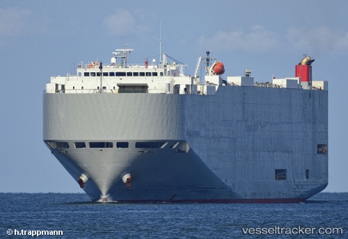
Vessel Michigan Highway IMO: 9339832, MMSI: 432633000 Vehicles Carrier
UTC, 36.03598, 168.89285, course: 91, speed: 15.2
UTC, 36.00452, 169.81688, course: 90, speed: 15.6
2026-02-24 16:02:48 UTC, 36.03214, 170.30521, course: 85, speed: 15.5
Live AIS position:
UTC. Open sea (no nearby ports in database)),
updated 2026-02-24 16:02:48 UTC.
Find the position of the vessel Michigan Highway on the map. The latter are known coordinates and path.
marine traffic ship tracker show on live map
The current position of vessel Michigan Highway is 36.03214 lat / 170.30521 lng. Updated: 2026-02-24 16:02:48 UTCDetails:
Last coordinates of the vessel:
UTC, 36.05915, 168.22305, course: 92, speed: 15.1UTC, 36.03598, 168.89285, course: 91, speed: 15.2
UTC, 36.00452, 169.81688, course: 90, speed: 15.6
2026-02-24 16:02:48 UTC, 36.03214, 170.30521, course: 85, speed: 15.5