 vesseltracker.com
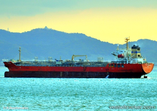
Vessel NO. 2 OCEAN PIONEER IMO: 9340439, MMSI: 538009910 Chemical/Oil Products Tanker
UTC, 22.07521, 66.78375, course: 206, speed: 1.3
UTC, 22.02546, 66.78598, course: 217, speed: 0.9
2026-02-09 15:33:47 UTC, 21.99479, 66.77900, course: 202, speed: 0.9
Live AIS position:
UTC. 131 nm W of Okha),
updated 2026-02-09 15:33:47 UTC.
Find the position of the vessel NO. 2 OCEAN PIONEER on the map. The latter are known coordinates and path.
marine traffic ship tracker show on live map
The current position of vessel NO. 2 OCEAN PIONEER is 21.99479 lat / 66.77900 lng. Updated: 2026-02-09 15:33:47 UTCCurrently sailing under the flag of Marshall Islands
NO. 2 OCEAN PIONEER built in 2006 year
Deadweight:
19991 tDetails:
Last coordinates of the vessel:
UTC, 22.11429, 66.76112, course: 185, speed: 1UTC, 22.07521, 66.78375, course: 206, speed: 1.3
UTC, 22.02546, 66.78598, course: 217, speed: 0.9
2026-02-09 15:33:47 UTC, 21.99479, 66.77900, course: 202, speed: 0.9