 vesseltracker.com
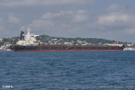
Vessel STAR ANGIE IMO: 9340714, MMSI: 636019670 Bulk Carrier
UTC, 29.78160, 122.07341, course: 228, speed: 0
UTC, 29.78146, 122.07340, course: 228, speed: 0
2026-02-26 14:31:19 UTC, 29.78148, 122.07343, course: 228, speed: 0
Live AIS position:
UTC. Near Daxie Pt),
updated 2026-02-26 14:31:19 UTC.
Find the position of the vessel STAR ANGIE on the map. The latter are known coordinates and path.
marine traffic ship tracker show on live map
The current position of vessel STAR ANGIE is 29.78148 lat / 122.07343 lng. Updated: 2026-02-26 14:31:19 UTCCurrently sailing under the flag of Liberia
STAR ANGIE built in 2007 year
Deadweight:
177932 tDetails:
Last coordinates of the vessel:
UTC, 29.78154, 122.07342, course: 227, speed: 0UTC, 29.78160, 122.07341, course: 228, speed: 0
UTC, 29.78146, 122.07340, course: 228, speed: 0
2026-02-26 14:31:19 UTC, 29.78148, 122.07343, course: 228, speed: 0