 vesseltracker.com
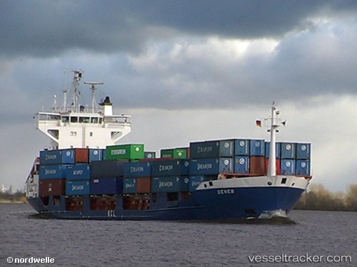
Vessel Deneb J IMO: 9344241, MMSI: 304941000 Container Ship
UTC, 19.69359, -69.53172, course: 288, speed: 13.3
UTC, 19.85044, -70.25936, course: 267, speed: 11.5
2026-02-18 09:30:23 UTC, 19.84833, -70.67167, course: -1, speed: 6
Live AIS position:
UTC. Near Puerto Plata),
updated 2026-02-18 09:30:23 UTC.
Find the position of the vessel Deneb J on the map. The latter are known coordinates and path.
marine traffic ship tracker show on live map
The current position of vessel Deneb J is 19.84833 lat / -70.67167 lng. Updated: 2026-02-18 09:30:23 UTCCurrently sailing under the flag of Antigua Barbuda
Deneb J built in 2006 year
Deadweight:
10831 tDetails:
Last coordinates of the vessel:
UTC, 19.52833, -69.20167, course: -1, speed: 13UTC, 19.69359, -69.53172, course: 288, speed: 13.3
UTC, 19.85044, -70.25936, course: 267, speed: 11.5
2026-02-18 09:30:23 UTC, 19.84833, -70.67167, course: -1, speed: 6