 vesseltracker.com
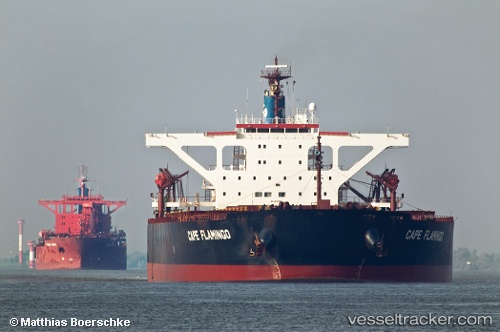
Vessel CAPE FLAMINGO IMO: 9344289, MMSI: 636021854 Bulk Carrier
Live AIS position:
UTC. Near Habana),
updated 2025-12-10 02:08:55 UTC.
Find the position of the vessel CAPE FLAMINGO on the map. The latter are known coordinates and path.
marine traffic ship tracker show on live map
The current position of vessel CAPE FLAMINGO is 23.13550 lat / -82.32937 lng. Updated: 2025-12-10 02:08:55 UTCCurrently sailing under the flag of Liberia
CAPE FLAMINGO built in 2005 year
Deadweight:
180201 tDetails:
Last coordinates of the vessel:
2025-12-10 02:08:55 UTC, 23.13550, -82.32937, course: 111, speed: 0