 vesseltracker.com
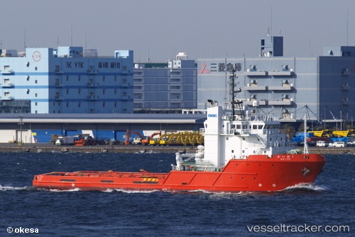
Vessel Kaiyu IMO: 9344576, MMSI: 432506000 Offshore Tug Supply Ship
UTC, 35.03985, 140.32143, course: 57, speed: 10
UTC, 35.28902, 140.66470, course: 36, speed: 10.2
2026-02-28 00:09:58 UTC, 35.57942, 140.92261, course: 36, speed: 10
Live AIS position:
UTC. 10 nm S of CHOSHI),
updated 2026-02-28 00:09:58 UTC.
Find the position of the vessel Kaiyu on the map. The latter are known coordinates and path.
marine traffic ship tracker show on live map
The current position of vessel Kaiyu is 35.57942 lat / 140.92261 lng. Updated: 2026-02-28 00:09:58 UTCDetails:
Last coordinates of the vessel:
UTC, 34.85930, 139.87415, course: -1, speed: 10.3UTC, 35.03985, 140.32143, course: 57, speed: 10
UTC, 35.28902, 140.66470, course: 36, speed: 10.2
2026-02-28 00:09:58 UTC, 35.57942, 140.92261, course: 36, speed: 10