 vesseltracker.com
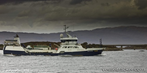
Vessel Ronia Pioneer IMO: 9345520, MMSI: 725002634 Fish Carrier
UTC, -45.47364, -72.82144, course: 238, speed: 0.1
UTC, -45.36959, -73.05636, course: 322, speed: 9.2
2026-02-14 20:04:07 UTC, -45.29260, -73.12175, course: 327, speed: 0.6
Live AIS position:
UTC. 16 nm NW of PUERTO CHACABUCO),
updated 2026-02-14 20:04:07 UTC.
Find the position of the vessel Ronia Pioneer on the map. The latter are known coordinates and path.
marine traffic ship tracker show on live map
The current position of vessel Ronia Pioneer is -45.29260 lat / -73.12175 lng. Updated: 2026-02-14 20:04:07 UTCDetails:
Last coordinates of the vessel:
UTC, -45.45612, -72.84449, course: 90, speed: 9.1UTC, -45.47364, -72.82144, course: 238, speed: 0.1
UTC, -45.36959, -73.05636, course: 322, speed: 9.2
2026-02-14 20:04:07 UTC, -45.29260, -73.12175, course: 327, speed: 0.6