 vesseltracker.com
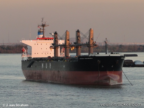
Vessel LUMOSO BERKAT IMO: 9346055, MMSI: 525013041 Bulk Carrier
UTC, -3.77989, 122.47651, course: 123, speed: 0.2
UTC, -3.77989, 122.47651, course: 123, speed: 0.2
2026-03-01 10:03:52 UTC, -3.78152, 122.47883, course: 322, speed: 0.1
Live AIS position:
UTC. 13 nm NW of KENDARI),
updated 2026-03-01 10:03:52 UTC.
Find the position of the vessel LUMOSO BERKAT on the map. The latter are known coordinates and path.
marine traffic ship tracker show on live map
The current position of vessel LUMOSO BERKAT is -3.78152 lat / 122.47883 lng. Updated: 2026-03-01 10:03:52 UTCCurrently sailing under the flag of Indonesia
LUMOSO BERKAT built in 2007 year
Deadweight:
55610 tDetails:
Last coordinates of the vessel:
UTC, -3.77989, 122.47651, course: 123, speed: 0.2UTC, -3.77989, 122.47651, course: 123, speed: 0.2
UTC, -3.77989, 122.47651, course: 123, speed: 0.2
2026-03-01 10:03:52 UTC, -3.78152, 122.47883, course: 322, speed: 0.1