 vesseltracker.com
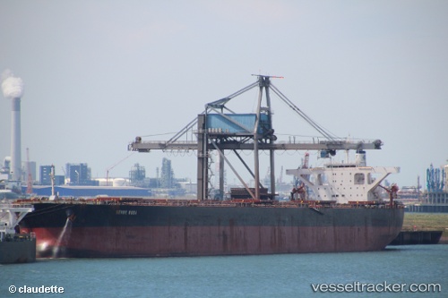
Vessel Berge Rosa IMO: 9346378, MMSI: 232006324 Ore Carrier
UTC, 9.72860, -14.22630, course: 344, speed: 0.2
UTC, 9.73296, -14.22463, course: 237, speed: 0.1
2026-02-03 17:36:03 UTC, 9.73454, -14.22554, course: 216, speed: 0.1
Live AIS position:
UTC. 33 nm NW of Conakry),
updated 2026-02-03 17:36:03 UTC.
Find the position of the vessel Berge Rosa on the map. The latter are known coordinates and path.
marine traffic ship tracker show on live map
The current position of vessel Berge Rosa is 9.73454 lat / -14.22554 lng. Updated: 2026-02-03 17:36:03 UTCCurrently sailing under the flag of United Kingdom
Berge Rosa built in 2006 year
Deadweight:
180230 tDetails:
Last coordinates of the vessel:
UTC, 9.72848, -14.22809, course: 23, speed: 0.1UTC, 9.72860, -14.22630, course: 344, speed: 0.2
UTC, 9.73296, -14.22463, course: 237, speed: 0.1
2026-02-03 17:36:03 UTC, 9.73454, -14.22554, course: 216, speed: 0.1