 vesseltracker.com
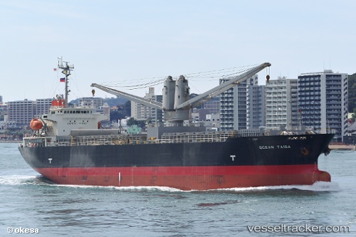
Vessel Ocean Taiga IMO: 9347140, MMSI: 372041000 Multi Purpose Carrier
UTC, 3.10043, 100.71045, course: 305, speed: 12.1
UTC, 3.39500, 100.42167, course: -1, speed: 11
2026-02-18 20:15:10 UTC, 3.78616, 100.13986, course: 321, speed: 11.1
Live AIS position:
UTC. 11 nm S of Pulau Jarak),
updated 2026-02-18 20:15:10 UTC.
Find the position of the vessel Ocean Taiga on the map. The latter are known coordinates and path.
marine traffic ship tracker show on live map
The current position of vessel Ocean Taiga is 3.78616 lat / 100.13986 lng. Updated: 2026-02-18 20:15:10 UTCCurrently sailing under the flag of Panama
Ocean Taiga built in 2006 year
Deadweight:
12909 tDetails:
Last coordinates of the vessel:
UTC, 2.86318, 100.97853, course: 310, speed: 12.2UTC, 3.10043, 100.71045, course: 305, speed: 12.1
UTC, 3.39500, 100.42167, course: -1, speed: 11
2026-02-18 20:15:10 UTC, 3.78616, 100.13986, course: 321, speed: 11.1