 vesseltracker.com
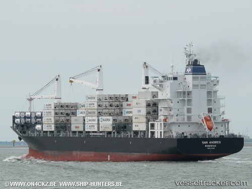
Vessel San Andres IMO: 9347255, MMSI: 636016649 Container Ship
UTC, 32.98367, 32.71890, course: 244, speed: 11.4
UTC, 32.90951, 32.48783, course: 246, speed: 11.1
2026-02-25 12:19:49 UTC, 32.67726, 31.94311, course: 251, speed: 10.3
Live AIS position:
UTC. 53 nm N of Bnei Darom),
updated 2026-02-25 12:19:49 UTC.
Find the position of the vessel San Andres on the map. The latter are known coordinates and path.
marine traffic ship tracker show on live map
The current position of vessel San Andres is 32.67726 lat / 31.94311 lng. Updated: 2026-02-25 12:19:49 UTCDetails:
Last coordinates of the vessel:
UTC, 33.30150, 33.53618, course: 247, speed: 11.6UTC, 32.98367, 32.71890, course: 244, speed: 11.4
UTC, 32.90951, 32.48783, course: 246, speed: 11.1
2026-02-25 12:19:49 UTC, 32.67726, 31.94311, course: 251, speed: 10.3