 vesseltracker.com
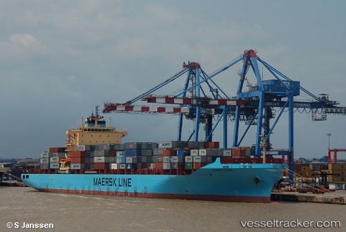
Vessel Maersk Izmir IMO: 9348168, MMSI: 566780000 Container Ship
UTC, 33.07333, 28.65167, course: -1, speed: 10
UTC, 32.97580, 29.19630, course: 104, speed: 10.8
2026-02-21 03:34:29 UTC, 32.92167, 29.44333, course: -1, speed: 10
Live AIS position:
UTC. 102 nm N of ABU QIR),
updated 2026-02-21 03:34:29 UTC.
Find the position of the vessel Maersk Izmir on the map. The latter are known coordinates and path.
marine traffic ship tracker show on live map
The current position of vessel Maersk Izmir is 32.92167 lat / 29.44333 lng. Updated: 2026-02-21 03:34:29 UTCDetails:
Last coordinates of the vessel:
UTC, 33.15167, 28.21333, course: -1, speed: 10UTC, 33.07333, 28.65167, course: -1, speed: 10
UTC, 32.97580, 29.19630, course: 104, speed: 10.8
2026-02-21 03:34:29 UTC, 32.92167, 29.44333, course: -1, speed: 10