 vesseltracker.com
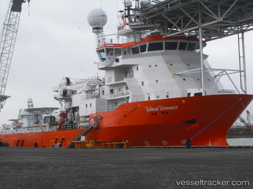
Vessel Normand Commander IMO: 9349370, MMSI: 258597000 Offshore Support Vessel
UTC, -22.85333, -43.14667, course: -1, speed: 0
UTC, -22.85333, -43.14667, course: -1, speed: 0
2026-02-04 16:56:33 UTC, -22.85333, -43.14667, course: -1, speed: 0
Live AIS position:
UTC. Near NITEROI),
updated 2026-02-04 16:56:33 UTC.
Find the position of the vessel Normand Commander on the map. The latter are known coordinates and path.
marine traffic ship tracker show on live map
The current position of vessel Normand Commander is -22.85333 lat / -43.14667 lng. Updated: 2026-02-04 16:56:33 UTCDetails:
Last coordinates of the vessel:
UTC, -22.85333, -43.14667, course: -1, speed: 0UTC, -22.85333, -43.14667, course: -1, speed: 0
UTC, -22.85333, -43.14667, course: -1, speed: 0
2026-02-04 16:56:33 UTC, -22.85333, -43.14667, course: -1, speed: 0