 vesseltracker.com
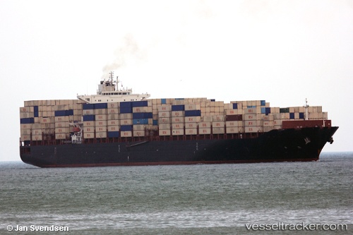
Vessel Shabdis IMO: 9349588, MMSI: 422031200 Container Ship
UTC, 31.17191, 123.24782, course: -1, speed: 0.3
UTC, 31.17296, 123.24705, course: -1, speed: 0.2
2026-02-25 19:19:52 UTC, 31.17394, 123.24681, course: -1, speed: 0.1
Live AIS position:
UTC. 39 nm NE of Lü-hua Shan),
updated 2026-02-25 19:19:52 UTC.
Find the position of the vessel Shabdis on the map. The latter are known coordinates and path.
marine traffic ship tracker show on live map
The current position of vessel Shabdis is 31.17394 lat / 123.24681 lng. Updated: 2026-02-25 19:19:52 UTCCurrently sailing under the flag of Iran
Shabdis built in 2009 year
Deadweight:
86018 tDetails:
Last coordinates of the vessel:
UTC, 31.17167, 123.24810, course: 31, speed: 0UTC, 31.17191, 123.24782, course: -1, speed: 0.3
UTC, 31.17296, 123.24705, course: -1, speed: 0.2
2026-02-25 19:19:52 UTC, 31.17394, 123.24681, course: -1, speed: 0.1