 vesseltracker.com
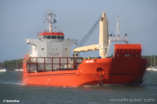
Vessel Hiri Chief IMO: 9352236, MMSI: 553111138 Landing Craft
UTC, -7.04421, 147.27518, course: 135, speed: 8.2
UTC, -7.26667, 147.48334, course: -1, speed: 8
2026-03-20 15:35:23 UTC, -7.39333, 147.60167, course: -1, speed: 8
Live Vessel Hiri Chief Analytics (details, animations, etc.)
Live AIS position: UTC. 42 nm SW of Tami Island), updated 2026-03-20 15:35:23 UTC.Find the position of the vessel Hiri Chief on the map. The latter are known coordinates and path.
marine traffic ship tracker show on live map
The current position of vessel Hiri Chief is -7.39333 lat / 147.60167 lng. Updated: 2026-03-20 15:35:23 UTCDetails:
Last coordinates of the vessel:
UTC, -6.76527, 147.00845, course: 138, speed: 9.1UTC, -7.04421, 147.27518, course: 135, speed: 8.2
UTC, -7.26667, 147.48334, course: -1, speed: 8
2026-03-20 15:35:23 UTC, -7.39333, 147.60167, course: -1, speed: 8