 vesseltracker.com
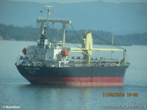
Vessel Ocean Friend IMO: 9354569, MMSI: 371969000 General Cargo Ship
UTC, -2.36182, 121.98444, course: 141, speed: 13.7
UTC, -2.61167, 122.20167, course: -1, speed: 14
2026-02-21 07:44:10 UTC, -2.89379, 122.56505, course: 131, speed: 13.3
Live AIS position:
UTC. 65 nm N of KENDARI),
updated 2026-02-21 07:44:10 UTC.
Find the position of the vessel Ocean Friend on the map. The latter are known coordinates and path.
marine traffic ship tracker show on live map
The current position of vessel Ocean Friend is -2.89379 lat / 122.56505 lng. Updated: 2026-02-21 07:44:10 UTCCurrently sailing under the flag of Panama
Ocean Friend built in 2006 year
Deadweight:
13030 tDetails:
Last coordinates of the vessel:
UTC, -2.25500, 121.77500, course: -1, speed: 0UTC, -2.36182, 121.98444, course: 141, speed: 13.7
UTC, -2.61167, 122.20167, course: -1, speed: 14
2026-02-21 07:44:10 UTC, -2.89379, 122.56505, course: 131, speed: 13.3