 vesseltracker.com
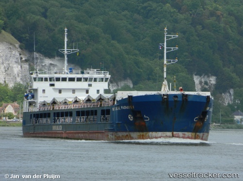
Vessel ANGORA 4 IMO: 9356969, MMSI: 636020314 General Cargo Ship
UTC, 45.19667, 28.86500, course: -1, speed: 0
UTC, 45.19801, 28.86600, course: 290, speed: 0
2026-02-22 03:09:23 UTC, 45.19803, 28.86601, course: 292, speed: 0
Live AIS position:
UTC. Near TULCEA),
updated 2026-02-22 03:09:23 UTC.
Find the position of the vessel ANGORA 4 on the map. The latter are known coordinates and path.
marine traffic ship tracker show on live map
The current position of vessel ANGORA 4 is 45.19803 lat / 28.86601 lng. Updated: 2026-02-22 03:09:23 UTCCurrently sailing under the flag of Liberia
ANGORA 4 built in 2006 year
Deadweight:
6933 tDetails:
Last coordinates of the vessel:
UTC, 45.19667, 28.86500, course: -1, speed: 0UTC, 45.19667, 28.86500, course: -1, speed: 0
UTC, 45.19801, 28.86600, course: 290, speed: 0
2026-02-22 03:09:23 UTC, 45.19803, 28.86601, course: 292, speed: 0