 vesseltracker.com
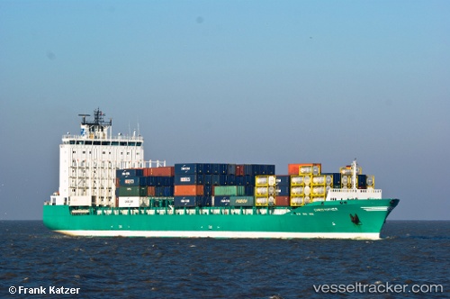
Vessel JUDITH IMO: 9359260, MMSI: 212006000 Container Ship
UTC, 56.65143, 12.84441, course: 88, speed: 0
UTC, 56.65143, 12.84442, course: 89, speed: 0
2026-02-14 20:02:31 UTC, 56.51299, 12.31438, course: 260, speed: 13.3
Live AIS position:
UTC. 15 nm NW of Mölle),
updated 2026-02-14 20:02:31 UTC.
Find the position of the vessel JUDITH on the map. The latter are known coordinates and path.
marine traffic ship tracker show on live map
The current position of vessel JUDITH is 56.51299 lat / 12.31438 lng. Updated: 2026-02-14 20:02:31 UTCCurrently sailing under the flag of Cyprus
JUDITH built in 2008 year
Deadweight:
20073 tDetails:
Last coordinates of the vessel:
UTC, 56.65143, 12.84441, course: 89, speed: 0.1UTC, 56.65143, 12.84441, course: 88, speed: 0
UTC, 56.65143, 12.84442, course: 89, speed: 0
2026-02-14 20:02:31 UTC, 56.51299, 12.31438, course: 260, speed: 13.3