 vesseltracker.com
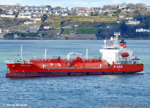
Vessel B Gas Maud IMO: 9363522, MMSI: 248102000 Lpg Tanker
UTC, 51.29165, 4.33817, course: 332, speed: 0.1
UTC, 51.29157, 4.33812, course: 332, speed: 0.2
2026-03-24 08:10:06 UTC, 51.29160, 4.33808, course: 333, speed: 0.1
Live Vessel B Gas Maud Analytics (details, animations, etc.)
Live AIS position: UTC. Near Lillo), updated 2026-03-24 08:10:06 UTC.Find the position of the vessel B Gas Maud on the map. The latter are known coordinates and path.
marine traffic ship tracker show on live map
The current position of vessel B Gas Maud is 51.29160 lat / 4.33808 lng. Updated: 2026-03-24 08:10:06 UTCCurrently sailing under the flag of Malta
B Gas Maud built in 2006 year
Deadweight:
5073 tDetails:
Last coordinates of the vessel:
UTC, 51.29173, 4.33828, course: 332, speed: 0.1UTC, 51.29165, 4.33817, course: 332, speed: 0.1
UTC, 51.29157, 4.33812, course: 332, speed: 0.2
2026-03-24 08:10:06 UTC, 51.29160, 4.33808, course: 333, speed: 0.1