 vesseltracker.com
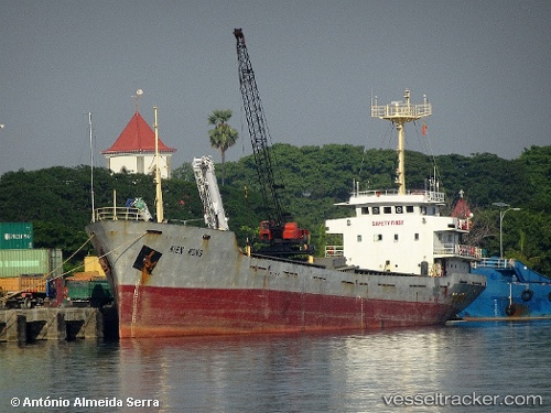
Vessel Kien Hung IMO: 9367877, MMSI: 574349000 General Cargo Ship
UTC, 11.75282, 119.61750, course: 299, speed: 8.7
UTC, 11.79327, 119.52521, course: 301, speed: 8.2
2026-01-29 02:52:54 UTC, 11.79327, 119.52521, course: 301, speed: 8.2
Live AIS position:
UTC. 29 nm NE of Malampaya),
updated 2026-01-29 02:52:54 UTC.
Find the position of the vessel Kien Hung on the map. The latter are known coordinates and path.
marine traffic ship tracker show on live map
The current position of vessel Kien Hung is 11.79327 lat / 119.52521 lng. Updated: 2026-01-29 02:52:54 UTCDetails:
Last coordinates of the vessel:
UTC, 11.60311, 119.99022, course: 279, speed: 9.1UTC, 11.75282, 119.61750, course: 299, speed: 8.7
UTC, 11.79327, 119.52521, course: 301, speed: 8.2
2026-01-29 02:52:54 UTC, 11.79327, 119.52521, course: 301, speed: 8.2