 vesseltracker.com
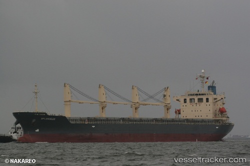
Vessel Obe Dinares IMO: 9370367, MMSI: 314489000 General Cargo Ship
UTC, -0.86800, 52.89842, course: 31, speed: 11.8
UTC, -0.36570, 53.19705, course: 32, speed: 11.6
2026-01-20 04:27:25 UTC, -0.35588, 53.20277, course: 32, speed: 11.6
Live AIS position:
UTC. 280 nm NW of Anse Kerlan),
updated 2026-01-20 04:27:25 UTC.
Find the position of the vessel Obe Dinares on the map. The latter are known coordinates and path.
marine traffic ship tracker show on live map
The current position of vessel Obe Dinares is -0.35588 lat / 53.20277 lng. Updated: 2026-01-20 04:27:25 UTCDetails:
Last coordinates of the vessel:
UTC, -1.11357, 52.74323, course: 42, speed: 12.1UTC, -0.86800, 52.89842, course: 31, speed: 11.8
UTC, -0.36570, 53.19705, course: 32, speed: 11.6
2026-01-20 04:27:25 UTC, -0.35588, 53.20277, course: 32, speed: 11.6