 vesseltracker.com
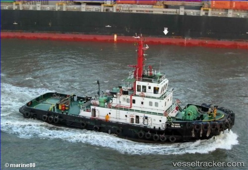
Vessel Tag Mamta IMO: 9371880, MMSI: 419060900 Tug
UTC, 20.91970, 71.51138, course: 0, speed: 0
UTC, 20.91970, 71.51136, course: 342, speed: 0
2026-02-25 10:52:18 UTC, 20.91970, 71.51136, course: 342, speed: 0
Live AIS position:
UTC. Near Port Pipavav),
updated 2026-02-25 10:52:18 UTC.
Find the position of the vessel Tag Mamta on the map. The latter are known coordinates and path.
marine traffic ship tracker show on live map
The current position of vessel Tag Mamta is 20.91970 lat / 71.51136 lng. Updated: 2026-02-25 10:52:18 UTCDetails:
Last coordinates of the vessel:
UTC, 20.91968, 71.51134, course: 0, speed: 0UTC, 20.91970, 71.51138, course: 0, speed: 0
UTC, 20.91970, 71.51136, course: 342, speed: 0
2026-02-25 10:52:18 UTC, 20.91970, 71.51136, course: 342, speed: 0