 vesseltracker.com
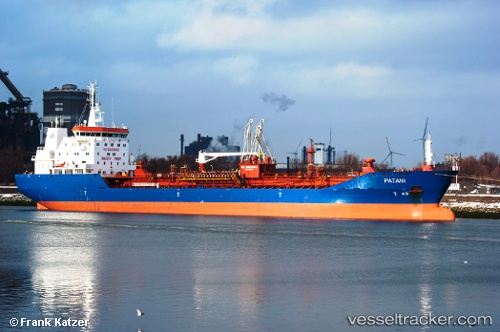
Vessel PATANI IMO: 9373644, MMSI: 255806366 Chemical/Oil Products Tanker
UTC, 71.49297, -123.87315, course: 70, speed: 44.7
UTC, -59.29649, 117.74754, course: 16, speed: 83.2
2026-02-12 21:53:17 UTC, -59.29649, 117.74754, course: 16, speed: 83.2
Live AIS position:
UTC. 166 nm SE of Muara Teweh),
updated 2026-02-12 21:53:17 UTC.
Find the position of the vessel PATANI on the map. The latter are known coordinates and path.
marine traffic ship tracker show on live map
The current position of vessel PATANI is -59.29649 lat / 117.74754 lng. Updated: 2026-02-12 21:53:17 UTCCurrently sailing under the flag of Portugal (MAR)
PATANI built in 2009 year
Deadweight:
16611 tDetails:
Last coordinates of the vessel:
UTC, 71.49297, -123.87315, course: 70, speed: 44.7UTC, 71.49297, -123.87315, course: 70, speed: 44.7
UTC, -59.29649, 117.74754, course: 16, speed: 83.2
2026-02-12 21:53:17 UTC, -59.29649, 117.74754, course: 16, speed: 83.2