 vesseltracker.com
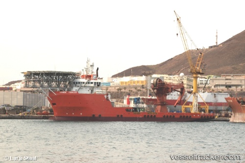
Vessel PRINCE JAMESON I IMO: 9374246, MMSI: 657251000 Offshore Tug/Supply Ship
UTC, 4.69459, 7.16959, course: -1, speed: 0
UTC, 4.69456, 7.16933, course: -1, speed: 0
2026-02-19 17:31:46 UTC, 4.69463, 7.16955, course: -1, speed: 0
Live AIS position:
UTC. Near Onne),
updated 2026-02-19 17:31:46 UTC.
Find the position of the vessel PRINCE JAMESON I on the map. The latter are known coordinates and path.
marine traffic ship tracker show on live map
The current position of vessel PRINCE JAMESON I is 4.69463 lat / 7.16955 lng. Updated: 2026-02-19 17:31:46 UTCCurrently sailing under the flag of Nigeria
PRINCE JAMESON I built in 2008 year
Deadweight:
4811 tDetails:
Last coordinates of the vessel:
UTC, 4.69460, 7.16956, course: -1, speed: 0UTC, 4.69459, 7.16959, course: -1, speed: 0
UTC, 4.69456, 7.16933, course: -1, speed: 0
2026-02-19 17:31:46 UTC, 4.69463, 7.16955, course: -1, speed: 0