 vesseltracker.com
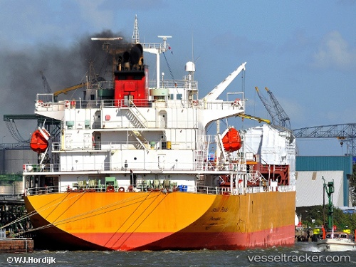
Vessel Stolt Pondo IMO: 9374521, MMSI: 319091700 Chemical Oil Products Tanker
UTC, 22.40500, -45.47833, course: -1, speed: 11
UTC, 22.22364, -46.00382, course: 250, speed: 12.1
2026-02-18 10:30:42 UTC, 22.05111, -46.50886, course: 252, speed: 12.8
Live AIS position:
UTC. 87 nm NW of Upper Northfield),
updated 2026-02-18 10:30:42 UTC.
Find the position of the vessel Stolt Pondo on the map. The latter are known coordinates and path.
marine traffic ship tracker show on live map
The current position of vessel Stolt Pondo is 22.05111 lat / -46.50886 lng. Updated: 2026-02-18 10:30:42 UTCCurrently sailing under the flag of Cayman Is
Stolt Pondo built in 2007 year
Deadweight:
33232 tDetails:
Last coordinates of the vessel:
UTC, 22.55667, -45.04333, course: -1, speed: 11UTC, 22.40500, -45.47833, course: -1, speed: 11
UTC, 22.22364, -46.00382, course: 250, speed: 12.1
2026-02-18 10:30:42 UTC, 22.05111, -46.50886, course: 252, speed: 12.8