 vesseltracker.com
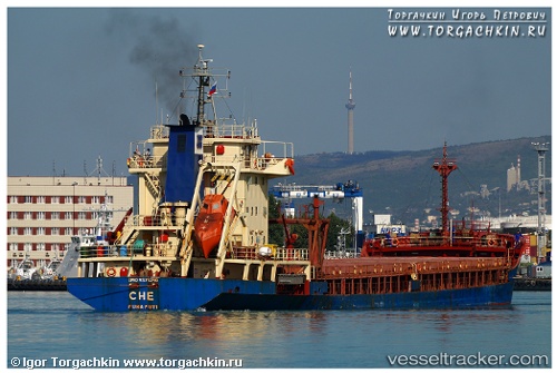
Vessel CHE IMO: 9375290, MMSI: 352005837 General Cargo
UTC, 44.80215, 37.83187, course: -1, speed: 52
UTC, 44.89234, 38.06194, course: -1, speed: 13
2026-02-24 02:11:04 UTC, 44.89699, 38.06076, course: -1, speed: 52.6
Live AIS position:
UTC. Near Krymsk),
updated 2026-02-24 02:11:04 UTC.
Find the position of the vessel CHE on the map. The latter are known coordinates and path.
marine traffic ship tracker show on live map
The current position of vessel CHE is 44.89699 lat / 38.06076 lng. Updated: 2026-02-24 02:11:04 UTCCurrently sailing under the flag of Panama
Details:
Last coordinates of the vessel:
UTC, 44.72825, 37.77524, course: -1, speed: 7.3UTC, 44.80215, 37.83187, course: -1, speed: 52
UTC, 44.89234, 38.06194, course: -1, speed: 13
2026-02-24 02:11:04 UTC, 44.89699, 38.06076, course: -1, speed: 52.6