 vesseltracker.com
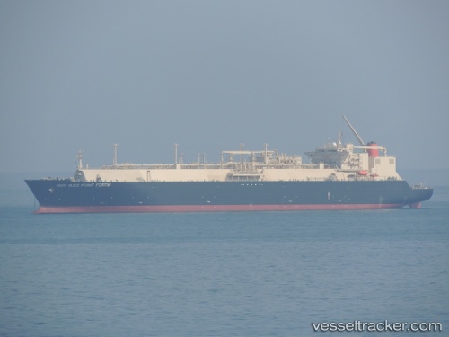
Vessel Point Fortin IMO: 9375721, MMSI: 370833000 Lng Tanker
UTC, 31.52390, -37.71534, course: 81, speed: 19.1
UTC, 31.64933, -36.82215, course: 82, speed: 18.7
2026-01-31 11:06:04 UTC, 31.68660, -36.50904, course: 80, speed: 19
Live AIS position:
UTC. 87 nm SW of Kafr Kanna),
updated 2026-01-31 11:06:04 UTC.
Find the position of the vessel Point Fortin on the map. The latter are known coordinates and path.
marine traffic ship tracker show on live map
The current position of vessel Point Fortin is 31.68660 lat / -36.50904 lng. Updated: 2026-01-31 11:06:04 UTCCurrently sailing under the flag of Panama
Point Fortin built in 2010 year
Deadweight:
79592 tDetails:
Last coordinates of the vessel:
UTC, 31.44915, -38.22337, course: 81, speed: 18.4UTC, 31.52390, -37.71534, course: 81, speed: 19.1
UTC, 31.64933, -36.82215, course: 82, speed: 18.7
2026-01-31 11:06:04 UTC, 31.68660, -36.50904, course: 80, speed: 19