 vesseltracker.com
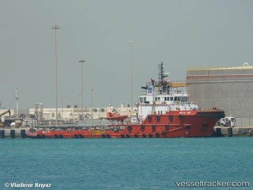
Vessel Halul 28 IMO: 9376983, MMSI: 466044000 Offshore Tug Supply Ship
UTC, 25.47691, 52.73919, course: 170, speed: 0
UTC, 25.47695, 52.73920, course: 170, speed: 0
2026-02-11 10:13:05 UTC, 25.44794, 52.75811, course: 169, speed: 0
Live AIS position:
UTC. 20 nm W of Abu al Bukhoosh),
updated 2026-02-11 10:13:05 UTC.
Find the position of the vessel Halul 28 on the map. The latter are known coordinates and path.
marine traffic ship tracker show on live map
The current position of vessel Halul 28 is 25.44794 lat / 52.75811 lng. Updated: 2026-02-11 10:13:05 UTCDetails:
Last coordinates of the vessel:
UTC, 25.47693, 52.73917, course: 170, speed: 0UTC, 25.47691, 52.73919, course: 170, speed: 0
UTC, 25.47695, 52.73920, course: 170, speed: 0
2026-02-11 10:13:05 UTC, 25.44794, 52.75811, course: 169, speed: 0