 vesseltracker.com
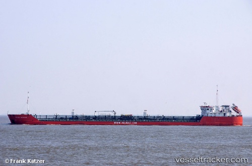
Vessel Armada Explorer IMO: 9377042, MMSI: 273311240 Chemical Oil Products Tanker
UTC, 44.47167, 48.07333, course: -1, speed: 0
UTC, 44.47167, 48.07333, course: -1, speed: 0
2026-02-05 03:42:04 UTC, 44.47167, 48.07333, course: -1, speed: 0
Live AIS position:
UTC. 82 nm S of Olya),
updated 2026-02-05 03:42:04 UTC.
Find the position of the vessel Armada Explorer on the map. The latter are known coordinates and path.
marine traffic ship tracker show on live map
The current position of vessel Armada Explorer is 44.47167 lat / 48.07333 lng. Updated: 2026-02-05 03:42:04 UTCDetails:
Last coordinates of the vessel:
UTC, 43.08306, 51.11285, course: 314, speed: 10UTC, 44.47167, 48.07333, course: -1, speed: 0
UTC, 44.47167, 48.07333, course: -1, speed: 0
2026-02-05 03:42:04 UTC, 44.47167, 48.07333, course: -1, speed: 0