 vesseltracker.com
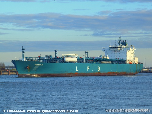
Vessel George N IMO: 9377224, MMSI: 636013814 Lpg Tanker
UTC, 24.15414, -80.56874, course: 58, speed: 16.4
UTC, 24.34957, -80.25350, course: 58, speed: 16.5
2026-02-17 22:09:34 UTC, 24.87460, -79.69303, course: 12, speed: 15.9
Live AIS position:
UTC. 45 nm E of Tavernier),
updated 2026-02-17 22:09:34 UTC.
Find the position of the vessel George N on the map. The latter are known coordinates and path.
marine traffic ship tracker show on live map
The current position of vessel George N is 24.87460 lat / -79.69303 lng. Updated: 2026-02-17 22:09:34 UTCCurrently sailing under the flag of Liberia
George N built in 2008 year
Deadweight:
43601 tDetails:
Last coordinates of the vessel:
UTC, 23.83041, -81.11288, course: 58, speed: 15.9UTC, 24.15414, -80.56874, course: 58, speed: 16.4
UTC, 24.34957, -80.25350, course: 58, speed: 16.5
2026-02-17 22:09:34 UTC, 24.87460, -79.69303, course: 12, speed: 15.9