 vesseltracker.com
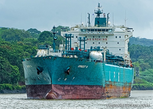
Vessel Ernest N IMO: 9377236, MMSI: 636013815 Lpg Tanker
UTC, 44.93232, -55.15251, course: 270, speed: 15.9
UTC, 44.92802, -56.02723, course: 273, speed: 12.3
2026-02-17 17:45:45 UTC, 44.94922, -56.72225, course: 273, speed: 15.5
Live AIS position:
UTC. 110 nm NW of La Cruz de Illas),
updated 2026-02-17 17:45:45 UTC.
Find the position of the vessel Ernest N on the map. The latter are known coordinates and path.
marine traffic ship tracker show on live map
The current position of vessel Ernest N is 44.94922 lat / -56.72225 lng. Updated: 2026-02-17 17:45:45 UTCCurrently sailing under the flag of Liberia
Ernest N built in 2009 year
Deadweight:
43563 tDetails:
Last coordinates of the vessel:
UTC, 44.91862, -54.44222, course: 271, speed: 15.2UTC, 44.93232, -55.15251, course: 270, speed: 15.9
UTC, 44.92802, -56.02723, course: 273, speed: 12.3
2026-02-17 17:45:45 UTC, 44.94922, -56.72225, course: 273, speed: 15.5