 vesseltracker.com
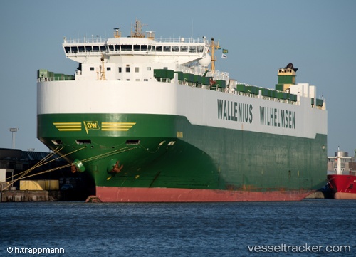
Vessel Aniara IMO: 9377494, MMSI: 266282000 Vehicles Carrier
UTC, 4.45500, -80.42500, course: -1, speed: 18
UTC, 4.01167, -80.93333, course: -1, speed: 19
2026-02-14 17:35:56 UTC, 3.61833, -81.38833, course: -1, speed: 19
Live AIS position:
UTC. 104 nm W of Piñas),
updated 2026-02-14 17:35:56 UTC.
Find the position of the vessel Aniara on the map. The latter are known coordinates and path.
marine traffic ship tracker show on live map
The current position of vessel Aniara is 3.61833 lat / -81.38833 lng. Updated: 2026-02-14 17:35:56 UTCCurrently sailing under the flag of Sweden
Aniara built in 2008 year
Deadweight:
30089 tDetails:
Last coordinates of the vessel:
UTC, 4.90821, -80.06487, course: 191, speed: 19.3UTC, 4.45500, -80.42500, course: -1, speed: 18
UTC, 4.01167, -80.93333, course: -1, speed: 19
2026-02-14 17:35:56 UTC, 3.61833, -81.38833, course: -1, speed: 19