 vesseltracker.com
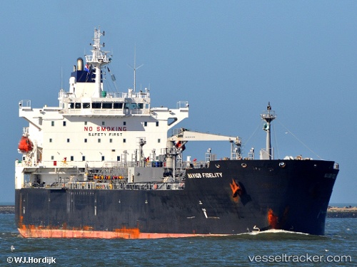
Vessel Magic Wand IMO: 9379143, MMSI: 636017797 Chemical Oil Products Tanker
UTC, 39.18992, 25.70640, course: 4, speed: 11.8
UTC, 39.59582, 25.73087, course: 340, speed: 10.7
2026-02-21 22:01:24 UTC, 39.81348, 25.63598, course: 118, speed: 1.8
Live AIS position:
UTC. 17 nm E of Moúdhros),
updated 2026-02-21 22:01:24 UTC.
Find the position of the vessel Magic Wand on the map. The latter are known coordinates and path.
marine traffic ship tracker show on live map
The current position of vessel Magic Wand is 39.81348 lat / 25.63598 lng. Updated: 2026-02-21 22:01:24 UTCCurrently sailing under the flag of Liberia
Magic Wand built in 2008 year
Deadweight:
46754 tDetails:
Last coordinates of the vessel:
UTC, 38.71673, 25.94878, course: 318, speed: 12.3UTC, 39.18992, 25.70640, course: 4, speed: 11.8
UTC, 39.59582, 25.73087, course: 340, speed: 10.7
2026-02-21 22:01:24 UTC, 39.81348, 25.63598, course: 118, speed: 1.8