 vesseltracker.com
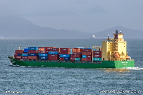
Vessel Cape Felton IMO: 9379375, MMSI: 538003181 Container Ship
UTC, 4.58035, 99.87968, course: 326, speed: 14.5
UTC, 5.06220, 99.58556, course: -1, speed: 10.8
2026-03-20 14:13:12 UTC, 5.06220, 99.58556, course: -1, speed: 10.8
Live Vessel Cape Felton Analytics (details, animations, etc.)
Live AIS position: UTC. 42 nm W of Bayan Lepas), updated 2026-03-20 14:13:12 UTC.Find the position of the vessel Cape Felton on the map. The latter are known coordinates and path.
marine traffic ship tracker show on live map
The current position of vessel Cape Felton is 5.06220 lat / 99.58556 lng. Updated: 2026-03-20 14:13:12 UTCDetails:
Last coordinates of the vessel:
UTC, 4.58035, 99.87968, course: 326, speed: 14.5UTC, 4.58035, 99.87968, course: 326, speed: 14.5
UTC, 5.06220, 99.58556, course: -1, speed: 10.8
2026-03-20 14:13:12 UTC, 5.06220, 99.58556, course: -1, speed: 10.8