 vesseltracker.com
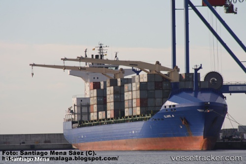
Vessel Claire A IMO: 9379387, MMSI: 271001092 Container Ship
UTC, 42.15698, 35.99579, course: 90, speed: 13
UTC, 42.17167, 36.64333, course: -1, speed: 12
2026-01-30 16:32:27 UTC, 42.17833, 36.93500, course: -1, speed: 12
Live AIS position:
UTC. 47 nm NE of Gerze),
updated 2026-01-30 16:32:27 UTC.
Find the position of the vessel Claire A on the map. The latter are known coordinates and path.
marine traffic ship tracker show on live map
The current position of vessel Claire A is 42.17833 lat / 36.93500 lng. Updated: 2026-01-30 16:32:27 UTCCurrently sailing under the flag of Turkey
Claire A built in 2008 year
Deadweight:
22028 tDetails:
Last coordinates of the vessel:
UTC, 42.16103, 35.62684, course: 89, speed: 12.8UTC, 42.15698, 35.99579, course: 90, speed: 13
UTC, 42.17167, 36.64333, course: -1, speed: 12
2026-01-30 16:32:27 UTC, 42.17833, 36.93500, course: -1, speed: 12