 vesseltracker.com
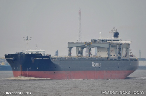
Vessel Corella Arrow IMO: 9385477, MMSI: 311018800 Bulk Carrier
UTC, -38.11579, 32.39963, course: 78, speed: 13.2
UTC, -38.05909, 32.85780, course: 70, speed: 14.7
2026-02-10 14:10:34 UTC, -37.93333, 33.61492, course: 73, speed: 14.4
Live AIS position:
UTC. Open sea, approx. 406 nm off the nearest listed port),
updated 2026-02-10 14:10:34 UTC.
Find the position of the vessel Corella Arrow on the map. The latter are known coordinates and path.
marine traffic ship tracker show on live map
The current position of vessel Corella Arrow is -37.93333 lat / 33.61492 lng. Updated: 2026-02-10 14:10:34 UTCDetails:
Last coordinates of the vessel:
UTC, -38.21167, 31.77167, course: -1, speed: 12UTC, -38.11579, 32.39963, course: 78, speed: 13.2
UTC, -38.05909, 32.85780, course: 70, speed: 14.7
2026-02-10 14:10:34 UTC, -37.93333, 33.61492, course: 73, speed: 14.4