 vesseltracker.com
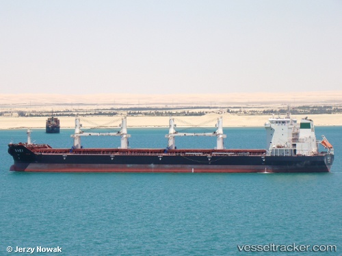
Vessel Oura IMO: 9387815, MMSI: 422034900 Bulk Carrier
UTC, 23.41090, 65.35066, course: -1, speed: 11.5
UTC, 23.23546, 65.75820, course: 113, speed: 11.2
2026-02-27 06:10:07 UTC, 23.08167, 66.09667, course: -1, speed: 11
Live AIS position:
UTC. 97 nm SW of Keti Bandar),
updated 2026-02-27 06:10:07 UTC.
Find the position of the vessel Oura on the map. The latter are known coordinates and path.
marine traffic ship tracker show on live map
The current position of vessel Oura is 23.08167 lat / 66.09667 lng. Updated: 2026-02-27 06:10:07 UTCDetails:
Last coordinates of the vessel:
UTC, 23.58634, 64.94635, course: -1, speed: 10.9UTC, 23.41090, 65.35066, course: -1, speed: 11.5
UTC, 23.23546, 65.75820, course: 113, speed: 11.2
2026-02-27 06:10:07 UTC, 23.08167, 66.09667, course: -1, speed: 11