 vesseltracker.com
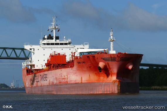
Vessel BOW LIND IMO: 9388314, MMSI: 257890000 Chemical/Oil Products Tanker
UTC, -9.09333, -26.73500, course: -1, speed: 11
UTC, -9.41667, -26.33333, course: -1, speed: 11
2026-01-31 06:11:37 UTC, -9.64333, -26.02833, course: -1, speed: 11
Live AIS position:
UTC. 373 nm S of Aquiraz),
updated 2026-01-31 06:11:37 UTC.
Find the position of the vessel BOW LIND on the map. The latter are known coordinates and path.
marine traffic ship tracker show on live map
The current position of vessel BOW LIND is -9.64333 lat / -26.02833 lng. Updated: 2026-01-31 06:11:37 UTCCurrently sailing under the flag of Norway (NIS)
BOW LIND built in 2011 year
Deadweight:
46047 tDetails:
Last coordinates of the vessel:
UTC, -8.83850, -27.04973, course: 134, speed: 11.6UTC, -9.09333, -26.73500, course: -1, speed: 11
UTC, -9.41667, -26.33333, course: -1, speed: 11
2026-01-31 06:11:37 UTC, -9.64333, -26.02833, course: -1, speed: 11