 vesseltracker.com
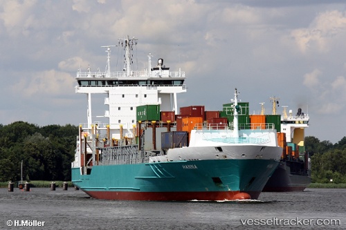
Vessel Hanna IMO: 9388481, MMSI: 244630026 Oil And Chemical Tank Barge
UTC, 51.89034, 4.40235, course: -1, speed: 2.5
UTC, 51.89034, 4.40235, course: -1, speed: 2.5
UTC, 51.89034, 4.40235, course: -1, speed: 2.5
2026-01-17 18:56:55 UTC, 51.89034, 4.40235, course: -1, speed: 2.5
Live AIS position:
UTC. Near ROTTERDAM PERNIS),
updated 2026-01-17 18:56:55 UTC.
Find the position of the vessel Hanna on the map. The latter are known coordinates and path.
marine traffic ship tracker show on live map
The current position of vessel Hanna is 51.89034 lat / 4.40235 lng. Updated: 2026-01-17 18:56:55 UTCCurrently sailing under the flag of Netherlands
Details:
Last coordinates of the vessel:
UTC, 51.89034, 4.40235, course: -1, speed: 2.5UTC, 51.89034, 4.40235, course: -1, speed: 2.5
UTC, 51.89034, 4.40235, course: -1, speed: 2.5
UTC, 51.89034, 4.40235, course: -1, speed: 2.5
2026-01-17 18:56:55 UTC, 51.89034, 4.40235, course: -1, speed: 2.5