 vesseltracker.com
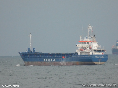
Vessel WILSON DUBLIN IMO: 9390109, MMSI: 314631000 General Cargo Ship
UTC, 42.69144, 4.51172, course: 37, speed: 10.2
UTC, 43.10165, 4.94407, course: 36, speed: 10.8
2026-02-18 15:25:41 UTC, 43.35663, 4.97074, course: 341, speed: 9.8
Live AIS position:
UTC. Near PORT DE BOUC),
updated 2026-02-18 15:25:41 UTC.
Find the position of the vessel WILSON DUBLIN on the map. The latter are known coordinates and path.
marine traffic ship tracker show on live map
The current position of vessel WILSON DUBLIN is 43.35663 lat / 4.97074 lng. Updated: 2026-02-18 15:25:41 UTCCurrently sailing under the flag of Barbados
WILSON DUBLIN built in 2008 year
Deadweight:
3778 tDetails:
Last coordinates of the vessel:
UTC, 42.54295, 4.36261, course: 36, speed: 10.5UTC, 42.69144, 4.51172, course: 37, speed: 10.2
UTC, 43.10165, 4.94407, course: 36, speed: 10.8
2026-02-18 15:25:41 UTC, 43.35663, 4.97074, course: 341, speed: 9.8