 vesseltracker.com
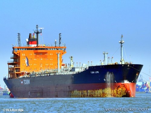
Vessel Torm Lene IMO: 9390769, MMSI: 220620000 Chemical Oil Products Tanker
UTC, 45.63146, -73.49150, course: -1, speed: 0
UTC, 45.63144, -73.49154, course: 215, speed: 0
2026-03-21 18:00:48 UTC, 45.63143, -73.49150, course: 215, speed: 0
Live Vessel Torm Lene Analytics (details, animations, etc.)
Live AIS position: UTC. Near Montréal-Est), updated 2026-03-21 18:00:48 UTC.Find the position of the vessel Torm Lene on the map. The latter are known coordinates and path.
marine traffic ship tracker show on live map
The current position of vessel Torm Lene is 45.63143 lat / -73.49150 lng. Updated: 2026-03-21 18:00:48 UTCDetails:
Last coordinates of the vessel:
UTC, 45.63145, -73.49155, course: -1, speed: 0UTC, 45.63146, -73.49150, course: -1, speed: 0
UTC, 45.63144, -73.49154, course: 215, speed: 0
2026-03-21 18:00:48 UTC, 45.63143, -73.49150, course: 215, speed: 0