 vesseltracker.com
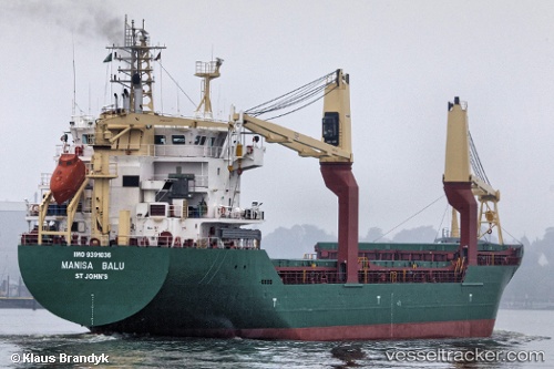
Vessel MANISA BALU IMO: 9391036, MMSI: 255899000 General Cargo
UTC, 5.22387, -4.05457, course: 257, speed: 0
UTC, 5.22384, -4.05469, course: 252, speed: 0.1
2026-02-25 17:39:31 UTC, 5.22473, -4.05588, course: 194, speed: 0.1
Live AIS position:
UTC. Near Vridi),
updated 2026-02-25 17:39:31 UTC.
Find the position of the vessel MANISA BALU on the map. The latter are known coordinates and path.
marine traffic ship tracker show on live map
The current position of vessel MANISA BALU is 5.22473 lat / -4.05588 lng. Updated: 2026-02-25 17:39:31 UTCCurrently sailing under the flag of Portugal
Details:
Last coordinates of the vessel:
UTC, 5.22385, -4.05468, course: 256, speed: 0.1UTC, 5.22387, -4.05457, course: 257, speed: 0
UTC, 5.22384, -4.05469, course: 252, speed: 0.1
2026-02-25 17:39:31 UTC, 5.22473, -4.05588, course: 194, speed: 0.1