 vesseltracker.com
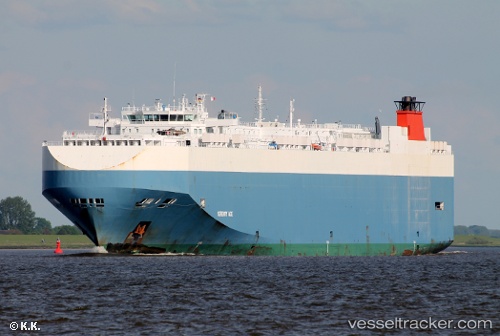
Vessel Serenity Ace IMO: 9391579, MMSI: 311002800 Vehicles Carrier
UTC, 48.25366, -124.00442, course: 114, speed: 9.2
UTC, 48.22430, -123.66051, course: 89, speed: 8.6
2026-02-14 20:35:39 UTC, 48.18748, -122.92638, course: 95, speed: 17.9
Live AIS position:
UTC. Near Port Townsend),
updated 2026-02-14 20:35:39 UTC.
Find the position of the vessel Serenity Ace on the map. The latter are known coordinates and path.
marine traffic ship tracker show on live map
The current position of vessel Serenity Ace is 48.18748 lat / -122.92638 lng. Updated: 2026-02-14 20:35:39 UTCCurrently sailing under the flag of Bahamas
Serenity Ace built in 2008 year
Deadweight:
21004 tDetails:
Last coordinates of the vessel:
UTC, 48.26814, -123.70234, course: 274, speed: 9.7UTC, 48.25366, -124.00442, course: 114, speed: 9.2
UTC, 48.22430, -123.66051, course: 89, speed: 8.6
2026-02-14 20:35:39 UTC, 48.18748, -122.92638, course: 95, speed: 17.9