 vesseltracker.com
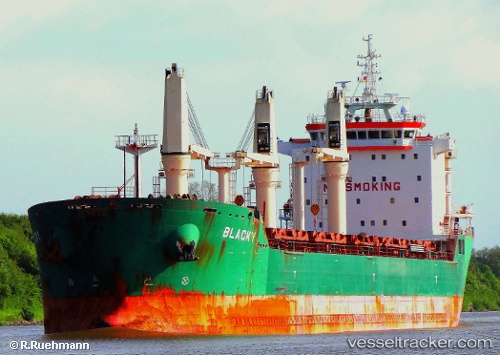
Vessel Blacky IMO: 9393149, MMSI: 212337000 Bulk Carrier
UTC, 1.72333, -37.32167, course: -1, speed: 12
UTC, 1.98500, -37.43667, course: -1, speed: 12
2026-03-06 20:09:06 UTC, 2.43167, -37.60333, course: -1, speed: 12
Live Vessel Blacky Analytics (details, animations, etc.)
Live AIS position: UTC. 262 nm S of Parelhas), updated 2026-03-06 20:09:06 UTC.Find the position of the vessel Blacky on the map. The latter are known coordinates and path.
marine traffic ship tracker show on live map
The current position of vessel Blacky is 2.43167 lat / -37.60333 lng. Updated: 2026-03-06 20:09:06 UTCCurrently sailing under the flag of Cyprus
Blacky built in 2008 year
Deadweight:
30801 tDetails:
Last coordinates of the vessel:
UTC, 1.28667, -37.12667, course: -1, speed: 11UTC, 1.72333, -37.32167, course: -1, speed: 12
UTC, 1.98500, -37.43667, course: -1, speed: 12
2026-03-06 20:09:06 UTC, 2.43167, -37.60333, course: -1, speed: 12