 vesseltracker.com
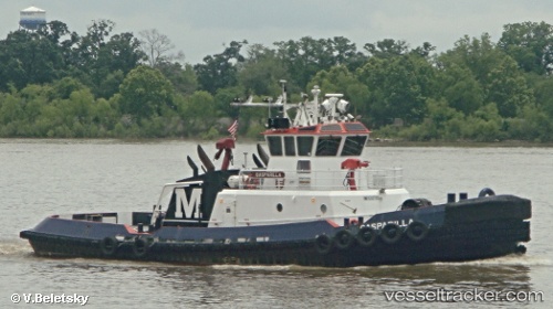
Vessel Gasparilla IMO: 9397389, MMSI: 367645040 Tug
UTC, 24.39667, -82.26833, course: -1, speed: 10
UTC, 24.40667, -82.59833, course: -1, speed: 9
2026-01-29 11:45:29 UTC, 24.70167, -82.68167, course: -1, speed: 10
Live AIS position:
UTC. 24 nm NE of Florida Straits),
updated 2026-01-29 11:45:29 UTC.
Find the position of the vessel Gasparilla on the map. The latter are known coordinates and path.
marine traffic ship tracker show on live map
The current position of vessel Gasparilla is 24.70167 lat / -82.68167 lng. Updated: 2026-01-29 11:45:29 UTCCurrently sailing under the flag of USA
Details:
Last coordinates of the vessel:
UTC, 24.42525, -81.86973, course: 261, speed: 9.7UTC, 24.39667, -82.26833, course: -1, speed: 10
UTC, 24.40667, -82.59833, course: -1, speed: 9
2026-01-29 11:45:29 UTC, 24.70167, -82.68167, course: -1, speed: 10