 vesseltracker.com
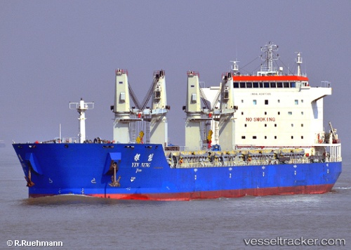
Vessel Yin Neng IMO: 9397705, MMSI: 413338000 Bulk Carrier
UTC, 11.92056, -139.07951, course: 98, speed: 9.9
UTC, 11.86373, -138.74664, course: 97, speed: 9.4
2026-02-17 06:32:11 UTC, 11.80102, -138.36653, course: 96, speed: 9.1
Live AIS position:
UTC. 381 nm E of Santa Rita),
updated 2026-02-17 06:32:11 UTC.
Find the position of the vessel Yin Neng on the map. The latter are known coordinates and path.
marine traffic ship tracker show on live map
The current position of vessel Yin Neng is 11.80102 lat / -138.36653 lng. Updated: 2026-02-17 06:32:11 UTCCurrently sailing under the flag of China
Details:
Last coordinates of the vessel:
UTC, 11.98045, -139.49376, course: 97, speed: 9.5UTC, 11.92056, -139.07951, course: 98, speed: 9.9
UTC, 11.86373, -138.74664, course: 97, speed: 9.4
2026-02-17 06:32:11 UTC, 11.80102, -138.36653, course: 96, speed: 9.1