 vesseltracker.com
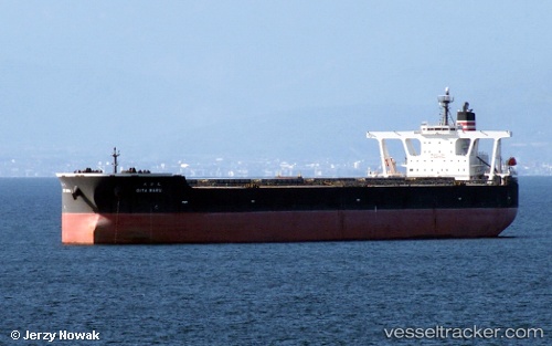
Vessel Oita Maru IMO: 9398151, MMSI: 431209000 Ore Carrier
UTC, 4.40314, 106.06950, course: 220, speed: 13.9
UTC, 3.88740, 105.72440, course: 216, speed: 12.8
2026-02-18 22:29:17 UTC, 3.49154, 105.44518, course: 214, speed: 12.5
Live AIS position:
UTC. 43 nm SE of Belida Terminal),
updated 2026-02-18 22:29:17 UTC.
Find the position of the vessel Oita Maru on the map. The latter are known coordinates and path.
marine traffic ship tracker show on live map
The current position of vessel Oita Maru is 3.49154 lat / 105.44518 lng. Updated: 2026-02-18 22:29:17 UTCDetails:
Last coordinates of the vessel:
UTC, 4.74778, 106.39791, course: 233, speed: 13.8UTC, 4.40314, 106.06950, course: 220, speed: 13.9
UTC, 3.88740, 105.72440, course: 216, speed: 12.8
2026-02-18 22:29:17 UTC, 3.49154, 105.44518, course: 214, speed: 12.5