 vesseltracker.com
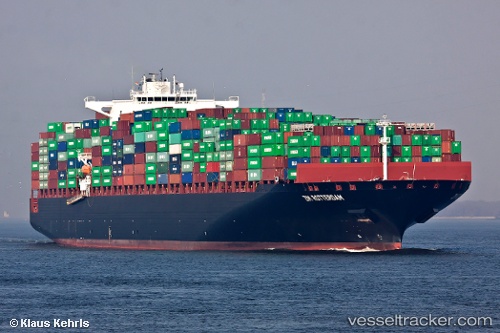
Vessel Zim Rotterdam IMO: 9398450, MMSI: 636014222 Container Ship
UTC, 29.93238, -88.44217, course: 46, speed: 1.3
UTC, 29.93392, -88.42483, course: 142, speed: 7.2
2026-02-08 18:13:38 UTC, 29.91942, -88.40475, course: 161, speed: 0.2
Live AIS position:
UTC. 26 nm SW of DAUPHIN ISLAND),
updated 2026-02-08 18:13:38 UTC.
Find the position of the vessel Zim Rotterdam on the map. The latter are known coordinates and path.
marine traffic ship tracker show on live map
The current position of vessel Zim Rotterdam is 29.91942 lat / -88.40475 lng. Updated: 2026-02-08 18:13:38 UTCDetails:
Last coordinates of the vessel:
UTC, 29.82898, -88.46935, course: 54, speed: 11.5UTC, 29.93238, -88.44217, course: 46, speed: 1.3
UTC, 29.93392, -88.42483, course: 142, speed: 7.2
2026-02-08 18:13:38 UTC, 29.91942, -88.40475, course: 161, speed: 0.2